There have been a lot of posts recently in the blogosphere regarding uses for Google's new satellite maps. Not that we haven't had satellite footage before, in fact I've seen higher resolution, but the
ease of use and accessibility is the real revolution. Already people are finding it an interesting research tool. (See the following post.) FYI, A short off-shoot here, but people ask me why some linux distros and open source apps are so successful when they are not so easy to use. What they don't realize is usability is only half the equation, accessibility is the other half. A great deal of accessibility can make up for quite a bit of usability. Google's new map tools have both. Eat dirt Terraserver... and thanks for the lesson Google.
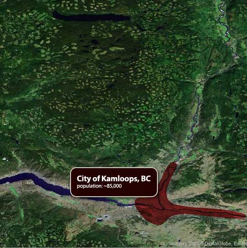
Google Maps' new satellite feature was just launched this week and already treehuggers are putting it to good use- over at Mezzoblue a British Columbia treehugger is displaying scary pictures of clearcutting. This tool is so easy to use that it could lead to a whole new world of corporate and environmental whistleblowing.
mezzoblue - Google Maps and Accountability
Also, Jeffery Veen had some interesting things to along similar lines:
Jeffrey Veen: Google is watching
Quote via
Treehugger: Treehuggers and Googlemaps
No comments:
Post a Comment